Free Acuna Videos
Acuna videos and clips for free download in 4K & HD for your next video project.
Sorry, no clips were found! Browse
Sponsored by iStock
LIMITED DEAL: Save 20% on 4K Video from iStock
![](https://media.istockphoto.com/id/1417480723/video/panoramic-view-of-huerquehue-national-park-with-the-lagoons-chico-verde-toro-and-tinquilco.jpg?b=1&s=640x640&k=20&c=pziNQYeOXjOp3PBk6nq1R1HILNE6PntZpfBcqJsw-Ck=)
Panoramic view of huerquehue national park with the lagoons chico, verde, toro and tinquilco between araucaria forests (Araucaria araucana) and the volcano villarrica in the background - aerial
![](https://media.istockphoto.com/id/1417478649/video/close-up-view-of-an-araucaria-forest-with-toro-lagoon-and-lake-verde-in-huerquehue-national.jpg?b=1&s=640x640&k=20&c=Dc-SUTihotYm1LTiP6DmKQiHvZuGP_hjXF_iPonzVkI=)
Close-up view of an araucaria (Araucaria araucana) forest with toro lagoon and lake verde in huerquehue national park - aerial
![](https://media.istockphoto.com/id/1338922211/video/aerial-hyperlapse-of-the-snow-capped-mountains-of-hornopiren-national-park-with-the-rio.jpg?b=1&s=640x640&k=20&c=YN09XxIuf3IUirGf0NC0Sa61crgUykaz9CKT3e8J0_8=)
Aerial hyperlapse of the snow-capped mountains of Hornopiren National Park with the Rio Blanco in Chile.
![](https://media.istockphoto.com/id/1435444898/video/aerial-top-down-orbit-of-tractor-between-waru-waru-avocado-plantations-in-a-farm-field-at.jpg?b=1&s=640x640&k=20&c=uYCTXpMxS2NHSP6NYxlnioXSrNk6TEfsLMUoYtR9IcU=)
Aerial top down orbit of tractor between waru waru avocado plantations in a farm field at daytime
![](https://media.istockphoto.com/id/1417469263/video/orbiting-a-ship-entering-the-pucon-dock-with-the-villarrica-volcano-in-the-background-at.jpg?b=1&s=640x640&k=20&c=KbcMeGq8Qtz2S9n2bLIboyUO-oeNJY5rmmMRxSHgvvw=)
Orbiting a ship entering the Pucon dock with the villarrica volcano in the background at sunset and with the sun appearing at the end - drone shot
![](https://media.istockphoto.com/id/1417468078/video/aerial-drone-shot-in-the-bay-of-pucon-chile-with-the-villarrica-volcano-in-the-background-at.jpg?b=1&s=640x640&k=20&c=g_Ik0CRucjnZuvQ7tS5ZfvPUIujkhmwPvsCl258dgHM=)
Aerial drone shot in the bay of pucon, Chile with the villarrica volcano in the background at sunset - aerial
![](https://media.istockphoto.com/id/1418822941/video/handheld-of-stream-of-water-flowing-between-rocks-near-nido-de-aguila-waterfall-surrounded-by.jpg?b=1&s=640x640&k=20&c=l4KLF4Tcx6R_Fdq5pyeP8NLW3hQzyoldWpI8rrCChM0=)
Handheld of stream of water flowing between rocks near Nido de Aguila waterfall surrounded by forest in Huerquehue National Park, Chile
![](https://media.istockphoto.com/id/1417467403/video/general-view-of-trees-and-the-villarrica-volcano-in-the-background-at-sunset-with-a-clear-sky.jpg?b=1&s=640x640&k=20&c=Xo59FBJMgruGgMjiBzHTrvHU7V42oakzU9CPIUJ-gjk=)
General view of trees and the villarrica volcano in the background at sunset with a clear sky - aerial
![](https://media.istockphoto.com/id/1417468305/video/aerial-shot-of-the-entrance-of-a-boat-to-la-poza-in-pucon-chile-with-many-other-ships-parked.jpg?b=1&s=640x640&k=20&c=rmCOQnr_k4StPcKtRAEw_uMM1kNWvQvF6wCix4MeaoM=)
Aerial shot of the entrance of a boat to La Poza in Pucon, Chile with many other ships parked and the small town in the background - drone shot
![](https://media.istockphoto.com/id/1417479836/video/pucon-bay-in-the-south-of-chile-with-its-tree-grove-on-the-waterfront-and-part-of-the-city.jpg?b=1&s=640x640&k=20&c=lI9sK6eNxLem0-GXTQVrTiq4QxhXWhS8Oq-7I3pFPZ0=)
Pucon bay in the south of chile with its tree grove on the waterfront and part of the city with the villarrica volcano in the background at sunset - aerial
![](https://media.istockphoto.com/id/1417666073/video/crane-shot-showing-people-enjoying-the-waterfall-la-nina-encantada-in-the-south-of-chile.jpg?b=1&s=640x640&k=20&c=HZo-3Kk3io3Jkh-trWxD8YfwUOMt2zIfZ0o9sL63QWQ=)
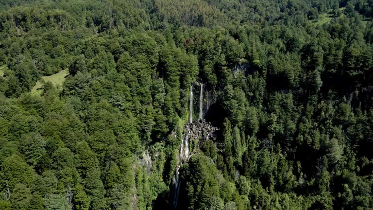
Crane shot showing people enjoying the waterfall la nina encantada in the south of chile - aerial view
![](https://media.istockphoto.com/id/1361923611/video/aerial-orbit-of-the-financial-district-of-santiago-de-chile-at-night-with-the-city.jpg?b=1&s=640x640&k=20&c=dR8V2jP36mOmHo5oRpt9a9EPFrA7UHtlrVVe_pK9QUg=)
Aerial orbit of the financial district of santiago de chile at night with the city illuminated by the city lights and the sunset in the background - drone shot
![](https://media.istockphoto.com/id/1358344196/video/aerial-view-of-the-pehuenche-border-crossing-between-chile-and-argentina-on-a-sunny-day-with.jpg?b=1&s=640x640&k=20&c=pCiIRAORVG3idBLUcWfyR44x0vShP9-ClwZpxX0FYEw=)
Aerial view of the pehuenche border crossing between chile and argentina on a sunny day with arid mountains of central Chile.
![](https://media.istockphoto.com/id/1418828621/video/handheld-of-hidden-mili-mili-misty-waterfall-falling-down-a-natural-pond-surrounded-by-green.jpg?b=1&s=640x640&k=20&c=CaPSW5XXGBYok8oy_BDewhUz-kYH9SMpXZ5zHY4UlU4=)
Handheld of hidden Mili Mili misty waterfall falling down a natural pond surrounded by green dense vegetation, Coñaripe, Chile
![](https://media.istockphoto.com/id/1338921917/video/aerial-hyperlapse-of-hornopiren-with-the-junction-of-the-white-river-and-the-pacific-ocean-at.jpg?b=1&s=640x640&k=20&c=Gwd6togZn8h7f2BRWKeK0Ien7hKmo_dKXBEAke6BtHs=)
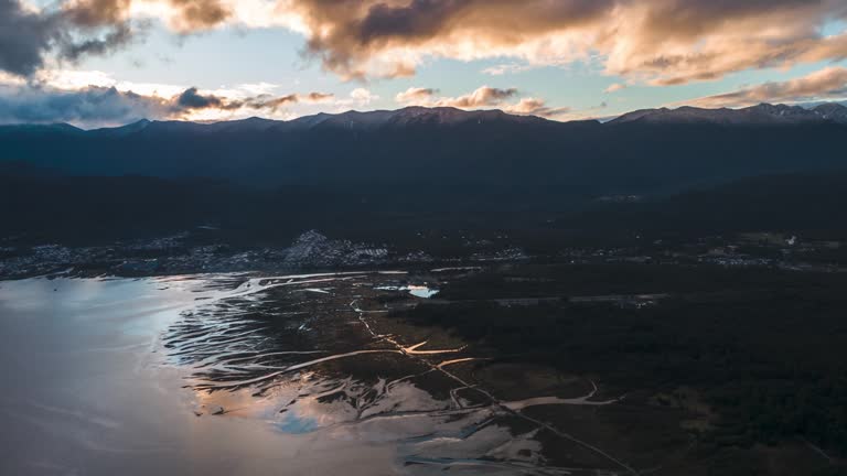
Aerial hyperlapse of Hornopiren with the junction of the White River and the Pacific Ocean at sunset.
![](https://media.istockphoto.com/id/1338922108/video/aerial-hyperlapse-of-tagua-tagua-lake-in-the-south-of-chile-with-a-ferry-going-to-puelche.jpg?b=1&s=640x640&k=20&c=ZVkMZzopusOgBAKaTnWmDkTJ88snde-h7fLTxKJ553E=)
Aerial hyperlapse of Tagua tagua lake in the south of chile with a ferry going to Puelche.
![](https://media.istockphoto.com/id/1435450679/video/aerial-panning-of-green-farm-field-surrounded-by-mountains-on-a-cloudy-day-cachapoal-valley.jpg?b=1&s=640x640&k=20&c=Smx8OZgIgcnqxySS0s-28CM_znrapFeSdI7jSorXwjM=)
Aerial panning of green farm field surrounded by mountains on a cloudy day, Cachapoal Valley, south of Santiago, Chile
![](https://media.istockphoto.com/id/1418828982/video/handheld-of-sun-beams-and-mist-from-hidden-mili-mili-waterfall-hidden-surrounded-by-dense.jpg?b=1&s=640x640&k=20&c=BuYqIxxT1K5v38Ve73tnfrJacMDkrADA2pXi0bx6SW8=)
Handheld of sun beams and mist from hidden Mili Mili waterfall hidden surrounded by dense green vegetation, Coñaripe, Chile
![](https://media.istockphoto.com/id/1435440014/video/aerial-pan-right-of-green-farm-fields-mountains-in-background-on-a-cloudy-day-cachapoal.jpg?b=1&s=640x640&k=20&c=bti9GjBIDxXndWxNwH_OYZuK6z3gc24leKXWdiPzGbI=)
Aerial pan right of green farm fields, mountains in background, on a cloudy day, Cachapoal Valley, south of Santiago, Chile
![](https://media.istockphoto.com/id/1358342508/video/panning-aerial-view-of-the-maule-lagoon-at-the-pehuenche-border-crossing-between-chile-and.jpg?b=1&s=640x640&k=20&c=rs_PNbE-S5wv6V2lJvpjaBCdgmUKV2GDBvL95ziNUIc=)
Panning aerial view of the maule lagoon at the pehuenche border crossing between chile and argentina on a sunny day with the andes mountains in the background.
![](https://media.istockphoto.com/id/1417479885/video/general-view-of-the-lagoons-of-the-huerquehue-national-park-in-southern-chile-on-a-sunny-day.jpg?b=1&s=640x640&k=20&c=UU0gpRQIJzFg7HIfYLz0_eMcEZhEiRqMXaFWqXOzryI=)
General view of the lagoons of the huerquehue national park in southern chile on a sunny day - aerial
![](https://media.istockphoto.com/id/1418824629/video/tilt-up-of-nido-de-aguila-waterfall-streaming-down-on-natural-pond-surrounded-by-green-dense.jpg?b=1&s=640x640&k=20&c=MGyIUC4Svr-By97E8KipauVwWAQmwvJP2QHlTWw59xI=)
Tilt up of Nido de Aguila waterfall streaming down on natural pond surrounded by green dense rainforest in Huerquehue National Park, Chile
![](https://media.istockphoto.com/id/1417733453/video/aerial-dolly-in-of-tinquilco-lake-and-andean-mountains-covered-in-rain-forest-at-golden-hour.jpg?b=1&s=640x640&k=20&c=SI4M6nlyDjuyGAMvCaUV1RU7cThwHuZ0Dch5l5V-UtU=)
Aerial dolly in of Tinquilco lake and Andean mountains covered in rain forest at golden hour, Huerquehue National Park, Chile
![](https://media.istockphoto.com/id/1339389652/video/aerial-view-of-the-cochamo-valley-on-a-cloudy-day-with-its-forest-and-river-towards-the.jpg?b=1&s=640x640&k=20&c=G7zvwJJbG6Esqdq9S-HrqgiIdDrXtJC9aZGqFuZvyno=)
Aerial view of the Cochamo Valley on a cloudy day with its forest and river towards the Pacific Ocean.
![](https://media.istockphoto.com/id/1339390779/video/crane-shot-of-the-entrance-to-the-cochamo-valley-with-its-mountains-full-of-snow-on-their-tips.jpg?b=1&s=640x640&k=20&c=ieaQ-eSerXNK58u5vY368TjPK53XtEzvauLs1q0x24c=)
Crane shot of the entrance to the cochamo valley with its mountains full of snow on their tips
![](https://media.istockphoto.com/id/1418829650/video/handheld-of-hidden-mili-mili-misty-waterfall-falling-into-natural-pond-surrounded-by-dense.jpg?b=1&s=640x640&k=20&c=3NDD_NRcMuBz8ZxnNbCLTc8F6XUhCVd6x9O-L80fKJ0=)
Handheld of hidden Mili Mili misty waterfall falling into natural pond surrounded by dense green vegetation, Coñaripe, Chile
![](https://media.istockphoto.com/id/1338921310/video/aerial-hyperlapse-of-an-island-in-the-middle-of-the-junction-of-rios-and-the-pacific-ocean.jpg?b=1&s=640x640&k=20&c=qg283mpgR57eXDOoanxte357s21z67fRbKfPQQX-3m0=)
Aerial hyperlapse of an island in the middle of the junction of Rios and the Pacific Ocean near Hornopiren with mountains and clouds in the background.
![](https://media.istockphoto.com/id/1418830892/video/handheld-of-hidden-mili-mili-misty-waterfall-streaming-into-natural-pond-surrounded-by-dense.jpg?b=1&s=640x640&k=20&c=vurYu1_OYuLOwvjXVGC_uHswYfZeeUnVSHo1cw_sMxk=)
Handheld of hidden Mili Mili misty waterfall streaming into natural pond surrounded by dense green vegetation, Coñaripe, Chile
![](https://media.istockphoto.com/id/1339469779/video/aerial-view-of-the-junction-of-the-rio-blanco-and-the-pacific-ocean-with-birds-flying-over.jpg?b=1&s=640x640&k=20&c=eZXTAqOlcPMebSgZe1Qx-OKp8dwizzZ0imI2O55zE0U=)
Aerial view of the junction of the Rio Blanco and the Pacific Ocean with birds flying over the water.
![](https://media.istockphoto.com/id/1358343489/video/backward-aerial-view-of-the-maule-lagoon-at-the-pehuenche-border-crossing-between-chile-and.jpg?b=1&s=640x640&k=20&c=MQkD5g-KsfqJngL-NIesNqFNeWnXQR9I4BtSKl-2M9g=)
Backward aerial view of the maule lagoon at the pehuenche border crossing between chile and argentina on a sunny day with the andes mountains in the background.
![](https://media.istockphoto.com/id/1435448980/video/aerial-top-down-dolly-out-of-a-blue-tractor-spraying-pesticides-on-waru-waru-avocado.jpg?b=1&s=640x640&k=20&c=8RNInWV-jhp4aIBdC5YQA2Qwjll6jbdzDQJm56fc5tQ=)
Aerial top down dolly out of a blue tractor spraying pesticides on waru waru avocado plantation in a farm field at daytime
![](https://media.istockphoto.com/id/1435447343/video/aerial-top-down-of-a-tractor-spraying-pesticides-alongside-waru-waru-avocado-plantations-in-a.jpg?b=1&s=640x640&k=20&c=tkiyovdipg4bNsoOqv1Hq3zK9amdi4pMlZR4ur1eYQg=)
Aerial top down of a tractor spraying pesticides alongside waru waru avocado plantations in a farm field on a sunny day
![](https://media.istockphoto.com/id/1435450680/video/aerial-top-down-dolly-out-of-tractor-spraying-pesticides-on-waru-waru-avocado-plantations-in.jpg?b=1&s=640x640&k=20&c=PGNqjfupnnpmQZge3Ehk7zbX4zhBJBVBhgiXuZf7AwU=)
Aerial top down dolly out of tractor spraying pesticides on waru waru avocado plantations in a farm field at daytime
![](https://media.istockphoto.com/id/1435446932/video/aerial-orbit-over-a-vineyard-with-a-blue-grape-harvester-in-the-center-passing-through-one-of.jpg?b=1&s=640x640&k=20&c=IFKfh7x_e_2ZaGvqBqYTHH72vNTVbKnoQs3T3Ap2X4k=)
Aerial orbit over a vineyard with a blue grape harvester in the center passing through one of the lines, Talagante, Chile
![](https://media.istockphoto.com/id/1435457124/video/aerial-top-down-dolly-in-of-tractor-spraying-pesticides-on-waru-waru-avocado-plantations-in-a.jpg?b=1&s=640x640&k=20&c=9IGXzIAr88K7oiz-o1gT18NlWknwmBg2w3Y_3FdbRDY=)
Aerial top down dolly in of tractor spraying pesticides on waru waru avocado plantations in a farm field at daytime
![](https://media.istockphoto.com/id/1435439995/video/aerial-dolly-in-of-tractor-between-waru-waru-avocado-plantations-in-a-farm-field-on-a-sunny.jpg?b=1&s=640x640&k=20&c=QpJ8GEKsmUnF96gy2jnpFFqs5DZy48jRWTuCfzJL26Q=)
Aerial dolly in of tractor between waru waru avocado plantations in a farm field on a sunny day
![](https://media.istockphoto.com/id/1435447339/video/aerial-top-down-dolly-in-of-blue-tractor-spraying-pesticides-on-waru-waru-avocado-plantations.jpg?b=1&s=640x640&k=20&c=ovGQJuEO-cMs949qvqR8nkUPKnnExg5QQGoKBReJFD8=)
Aerial top down dolly in of blue tractor spraying pesticides on waru waru avocado plantations in a farm field at daytime
![](https://media.istockphoto.com/id/1361919014/video/aerial-orbit-of-the-chilean-flag-waving-in-vitacuras-bicentennial-park-with-people-walking-on.jpg?b=1&s=640x640&k=20&c=Fbehkw5q9rUSSv1nCy3IIeIF6zy_g8XARJBv1ZV4uWc=)
Aerial orbit of the Chilean flag waving in vitacura's bicentennial park with people walking on their walkways - drone shot
![](https://media.istockphoto.com/id/1435437037/video/aerial-top-down-orbit-of-a-tractor-spraying-pesticides-alongside-waru-waru-avocado.jpg?b=1&s=640x640&k=20&c=Vfd6IvF5JV3wU5IcVLF0tp5DmVyKlvnC3buh2LilF78=)
Aerial top down orbit of a tractor spraying pesticides alongside waru waru avocado plantations in a farm field on a sunny day
![](https://media.istockphoto.com/id/1358343357/video/backward-aerial-view-of-the-maule-lagoon-at-the-pehuenche-border-crossing-between-chile-and.jpg?b=1&s=640x640&k=20&c=LF4AmomU_jtqF0JEr0gQ4ZaAHA1JXat7VYqICHg86ts=)
Backward aerial view of the maule lagoon at the pehuenche border crossing between chile and argentina on a sunny day with the andes mountains in the background.